Summit County slipped into subzero cold this morning with temperatures in the negative teens after a weekend storm brought more snow than expected, but only for some.
The Krystalized Weather Station in Dillon bottomed out at negative 14 Fahrenheit today, the coldest day since Dec. 29 when we reported negative 2 degrees.
Coldest of the cold in Summit today was negative 20s in Summit Cove and parts of Breck, according to Wunderground. Outside of Fraser in Grand County a weather station reported negative 33.
Even after the sun came out, we were stuck below zero for several hours. Temperatures will creep into the 20s with subzero windchills above treeline. Winds are already gusting over 40 miles per hour at Loveland Pass, over 60 miles per hour up high at Breck.
This morning’s Arctic chill follows a widespread storm that began Friday evening and continued through late Sunday, bringing over a foot of snow to Breckenridge, Vail and Beaver Creek. That is a few inches more than expected.
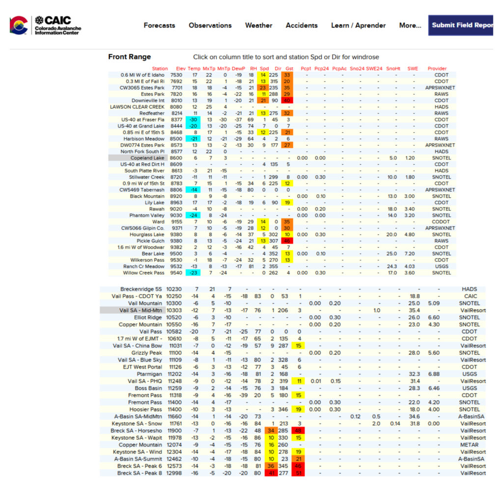
Ski areas along the Continental Divide were drier with 8 inches at Keystone and 6 inches at Loveland. That was right in line with predictions. Winter Park claimed slightly more than expected with 11 inches.
Underproducing were storms down south, where Wolf Creek managed only 12 inches. Forecasters were calling up to 20 inches there. The deepest snow fell on Monarch and Snowmass with 15 inches each.
This Arctic storm continues to pummel the nation. At DIA more than 100 flights are delayed or cancelled this morning for adverse conditions out east and down south. Over the weekend nearly 1600 flights were grounded.
Even indoor sports were impacted. The Nuggets away game in Memphis last night was postponed. The Breckenridge Vipers semi-pro hockey team cancelled its road trip to Mansfield, Texas.