Mayuary is back with a vengeance.
Our favorite quasi-season in the High Country arrives with 24 hours of heavy, wet, springlike snow. National Weather Service has released a winter storm warning for “the crest and eastern slopes of the Front Range,” aka the Continental Divide east into Golden, good through 6 a.m. Wednesday.
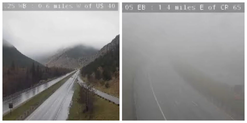
But it’s coming a little later than expected. Forecasters thought it would ramp up overnight. This morning the I-70 mountain corridor is mostly wet with dense fog blanketing the foothills. There’s even a touch of sun in Summit County at 7:30 a.m.
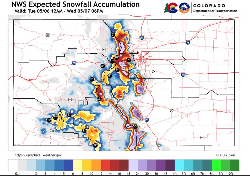
When the storm kicks into high gear – and forecasters are convinced: it will hit overdrive – mountain passes above 12,000 feet will claim the most snow:
- 8-12 inches at Hoosier Pass (Breckenridge)
- 12-18 inches at Loveland Pass and the Eisenhower-Johnson tunnels
- 18-24 inches at Berthoud Pass
The Front Range foothills and plains will be soaked with rain:
- Up to 1 inch on the eastern plains
- 1-1.5 inches in Fort Collins and Greeley
- 1.5-2 inches in Boulder, Denver and Castle Rock
Summit’s emergency management team reminds you to stay off the roads during the meat of the storm, especially I-70 between Summit and the Front Range.
“If you choose to drive, expect severely extended travel times,” emergency management said in a statement. “Or more likely, (expect) to become stranded in your vehicle for an extended period.”
Hope you didn’t swap your snow tires early!